Antarctica
February - March, 2019
I boarded the Hurtigruten ship MS Midnatsol from the port of Ushuaia, Tierra del Fuego. I had chosen to voyage with Hurtigruten, as I had sailed with them on a previous voyage to the Arctic, and had been impressed by their excellent record on sustainability.
We set sail across the notorious Drake Passage to Antarctica. My artistic intention throughout the voyage was to continue with the series ‘ship drawings’, and to photograph and video through the various, portholes and windows, or the eyes or lens of the ship. Whilst on land in Antarctica I photographed the various wireless/research stations we visited both active like Browns Station and Arctowski Station, or abandoned as in Whalers Bay where the absence of presence was particularly poignant.
Day 1: 27 February 2019, Ushuaia, Tierra del Fuego Province, Argentina. 54.8019° S, 68.3030° W
Ushuaia is a resort town in Argentina. It's located on the Tierra del Fuego archipelago, the southernmost tip of South America, nicknamed the “End of the World.” The windswept town, perched on a steep hill, is surrounded by the Martial Mountains and the Beagle Channel. It's the gateway to Antarctica.

‘Ship Drawing’, Ushuaia, 27 February 2019. © Anne Lydiat

Port of Ushuaia, Argentina. Photo: © Anne Lydiat, 2019
‘Ship Drawing’, Ushuaia, 27 February 2019. © Anne Lydiat
Port of Ushuaia, Argentina. Photo: © Anne Lydiat, 2019
Day 2: 28 February 2019, Drake Passage.
Drake passage, named after the 16th century English explorer Sir Francis Drake, is the body of water between South America’s Cape Horn, Chile, Argentina and the South Shetland Islands of Antarctica. It is considered to be one of the most treacherous voyages for ships to make as it, meets no resistance from any landmass waves can top 40 ft (12 m)

‘Ship Drawing’, Drake Passage, 28 February 2019. © Anne Lydiat

At sea onboard the MS Midnatsol, Drake Passage. Photo: © Anne Lydiat, 2019

Wake of the ship MS Midnatsol, Drake Passage. Photo: © Anne Lydiat, 2019

At sea, Drake Passage. Photo: © Anne Lydiat, 2019

At sea, Drake Passage. Photo: © Anne Lydiat, 2019
Day 3: 1 March 2019, Half Moon Island. 62.5884° S, 59.9215°W
Half Moon Island is a crescent-moon piece of land formed by long extinct volcanoes lying 1.35 km north of Burgas Peninsula, Livingston Island in the South Shetland Islands of the Antarctic Peninsula region. It first attracted whalers and sealers in the early 1800’s. ‘Camara’ Base is the Argentine Antarctic base and scientific research station name after Frigate Lieutentant Naval Aviator Juan Ramon Camara.

‘Ship Drawing’, Southern Ocean, 1 March 2019. © Anne Lydiat

‘Ship Drawing’, Southern Ocean, 1 March 2019. © Anne Lydiat

Half Moon Island, our first landing place welcomed by walrus. Photo: © Anne Lydiat. 2019

Half Moon Island, cobbled beach with remains of a whaling dory, type of shallow, planked boat. Photo: © Anne Lydiat. 2019

Heading to the Argentine Antarctic summer research station ‘Camara’. Photo: © Anne Lydiat 2019
Day 4: 2 March 2019, Whalers Bay, Port Foster, Deception Island. 62.9594° S, 60.6451° W
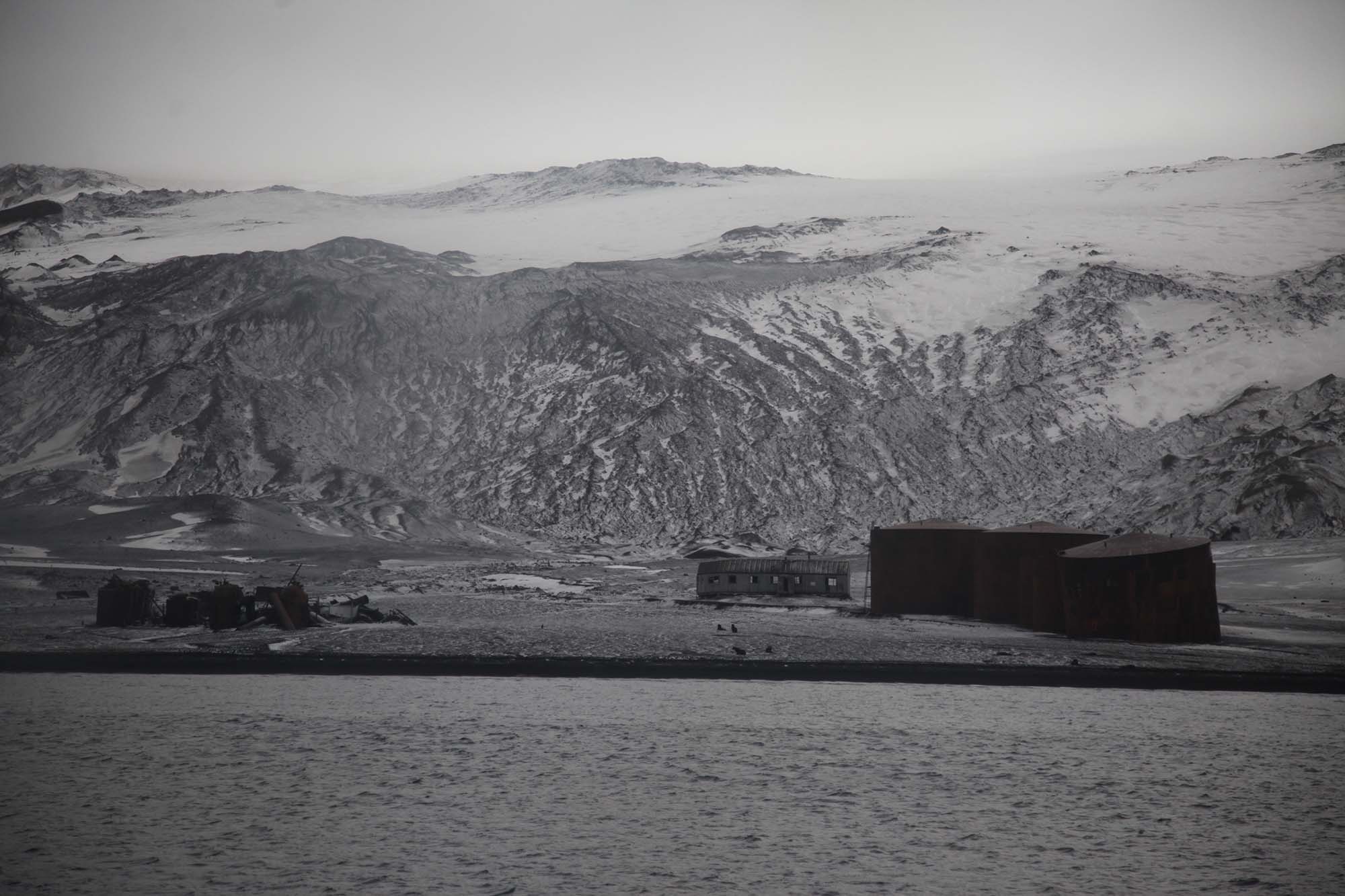
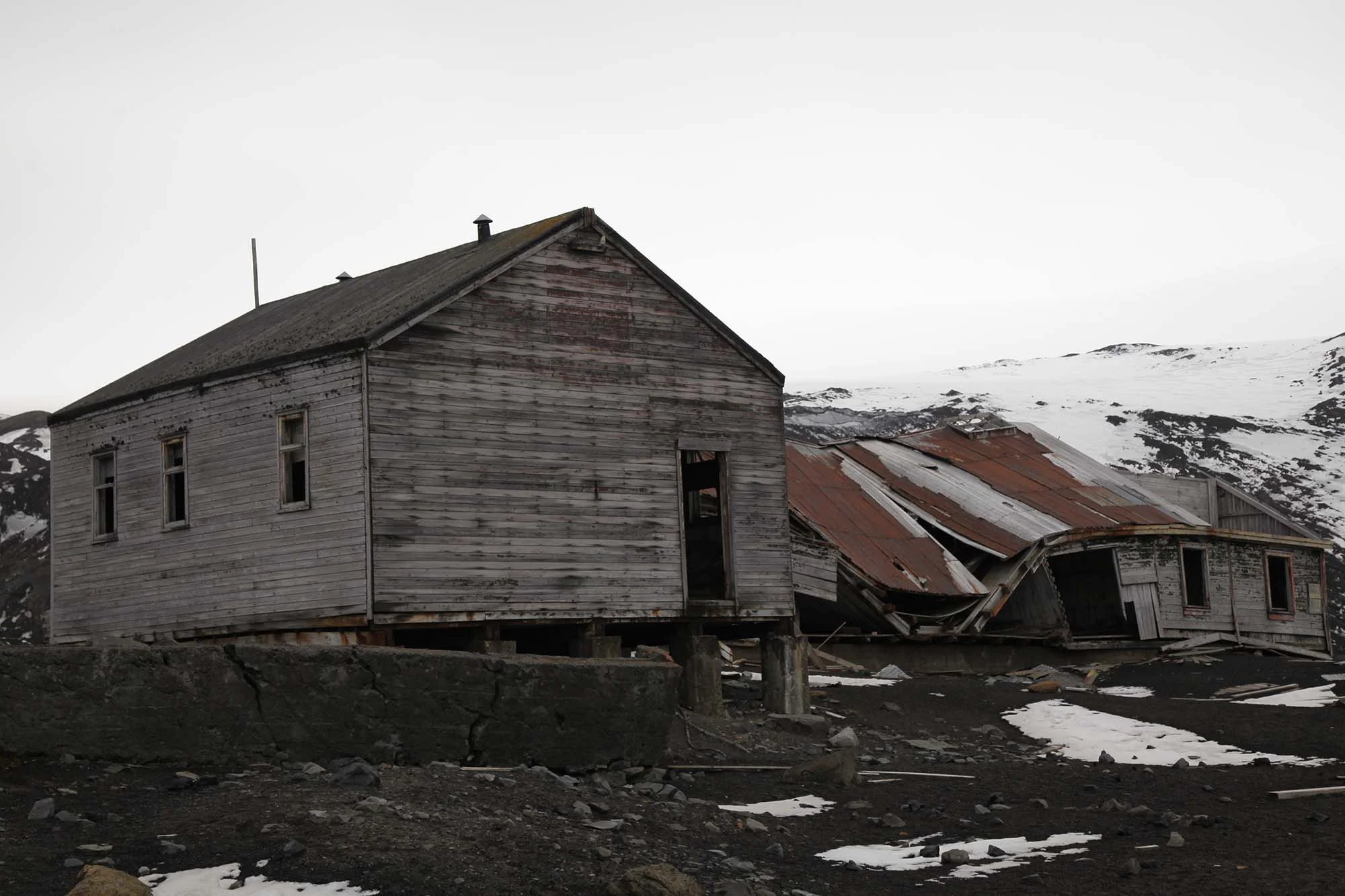
Whalers Bay is a small bay entered between Fildes Point and Penfold Point at the east side of Port Foster, Deception Island, in the South Shetland Islands of Antarctica. The bay was so named by the French Antarctic Expedition, 1908-10, under Charcot, because of its use at that time by whalers. Whalers Bay is Historic Site and Monument no 71 (Antarctic Treaty) including the remains of the Norwegian Hektor Whaling Station - the site of the Whaler’s Cemetery and other whaling remains.
I photographed the remains of the old whaling station with its rusty boilers and huge rusted tanks used to store whale oil. The stark white crosses of the whalers’ cemetery, the whalebones and the derelict wooden boats can be viewed against the barren landscape of grey and brown amidst a landscape of historic buildings.

‘Ship Drawing’, Whalers Bay, 2 March 2019. © Anne Lydiat

Whalers Bay, Deception Island. Photo taken from onboard Midnatsol: © Anne Lydiat, 2019
Whalers Bay, Deception Island. Photo taken from onboard Midnatsol: © Anne Lydiat, 2019

Whale Oil Silos, Whalers Bay, Deception Island. Photo: © Anne Lydiat, 2019

Whale Oil Silos, Whalers Bay, Deception Island. Photo: © Anne Lydiat, 2019

Whale Oil Silos, Whalers Bay, Deception Island. Photo: © Anne Lydiat, 2019

Whale Oil Silos, Whalers Bay, Deception Island. Photo: © Anne Lydiat, 2019

Whalers Bay, Deception Island. Photo: © Anne Lydiat, 2019

Whalers Bay, Deception Island. Photo: © Anne Lydiat, 2019

Whalers Bay, Deception Island. Photo: © Anne Lydiat, 2019

Whalers Bay, Deception Island. Photo: © Anne Lydiat, 2019

Whalers Bay, Deception Island. Photo: © Anne Lydiat, 2019

Whalers Cemetery, Whalers Bay, Deception Island. Photo: © Anne Lydiat, 2019

Remains of Hunting Lodge, Whalers Bay, Deception Island. Photo: © Anne Lydiat, 2019

Whalers Bay, Deception Island. Photo: © Anne Lydiat, 2019

Whalers Bay, Deception Island. Photo: © Anne Lydiat, 2019

Whalers Bay, Deception Island. Photo: © Anne Lydiat, 2019

Whalers Bay, Deception Island. Photo: © Anne Lydiat, 2019

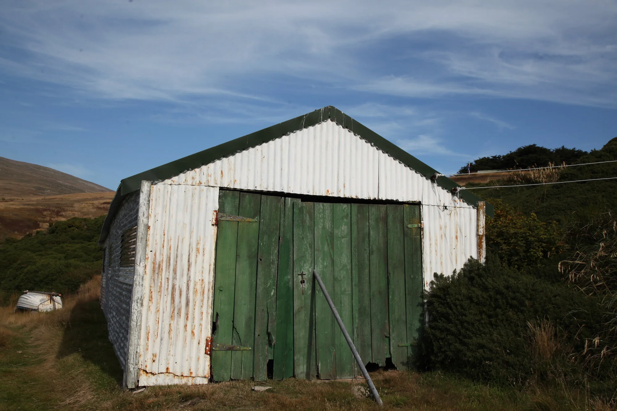
Aircraft Hanger, (side view) Whalers Bay, Deception Island. Photo: © Anne Lydiat, 2019

Aircraft Hanger, Whalers Bay, Deception Island. Photo: © Anne Lydiat, 2019

Aircraft Hanger, (Front View) Whalers Bay, Deception Island. Photo: © Anne Lydiat, 2019

Aircraft Hanger, Whalers Bay, Deception Island. Photo: © Anne Lydiat, 2019

Remains of building and whaling dory, Whalers Bay, Deception Island. Photo: © Anne Lydiat, 2019

Remains of building, Whalers Bay, Deception Island. Photo: © Anne Lydiat, 2019

Whalers Bay, Deception Island. Photo: © Anne Lydiat, 2019
Whalers Bay, Deception Island. Photo: © Anne Lydiat, 2019

Remains of a whaling dory, Whalers Bay, Deception Island. Photo: © Anne Lydiat, 2019

Remains of a whaling dory, Whalers Bay, Deception Island. Photo: © Anne Lydiat, 2019

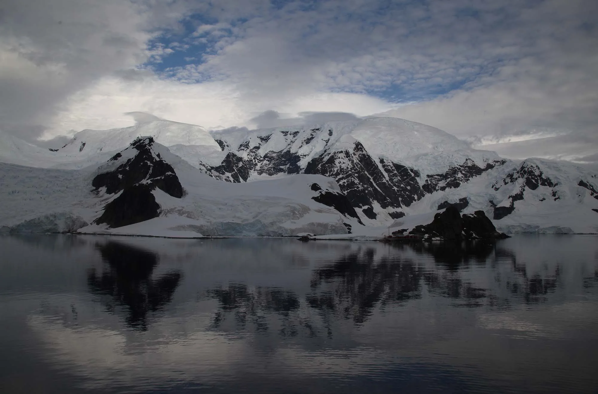
Day 5: 3 March 2019, Brown Station, Paradise Bay. 64.8954° S, 62.8706° W
Almirante Brown Antarctic Base or Brown Station, is an abandoned Argentine research centre situated on the small rocky Sanavirón Peninsula deep within Paradise Bay, on the Danco Coast, in Graham Land, Antarctica.
Opened in 1951 as a meteorological station, it was taken over by the Argentine Antarctic Institute in the mid-sixties and has become one of the most comprehensive biology laboratories in the region. It is named after Admiral William Brown, a man born in Ireland, known as the father of the Argentine Navy.

‘Ship Drawing’, Paradise Bay, 3 March 2019. © Anne Lydiat

Brown Station, Antarctica. Photo: © Anne Lydiat, 2019

Brown Station, Antarctica. Photo: © Anne Lydiat, 2019
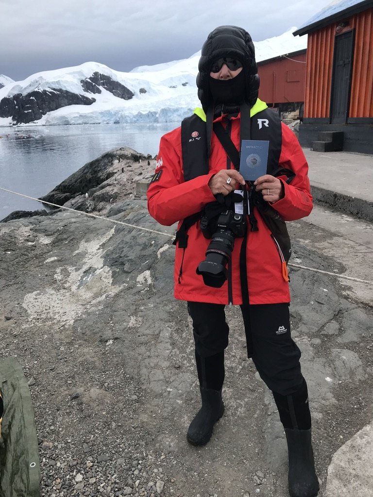
The artist Lucy Orta gave me a copy of her 'Antartica World Passport: Diversity United’

Brown Station, Antarctica. Photo: © Anne Lydiat, 2019

Brown Station, Antarctica. Photo: © Anne Lydiat, 2019

Artist’s View, Antarctica. Photo: © Anne Lydiat, 2019

Artist’s View, Antarctica. Photo: © Anne Lydiat, 2019
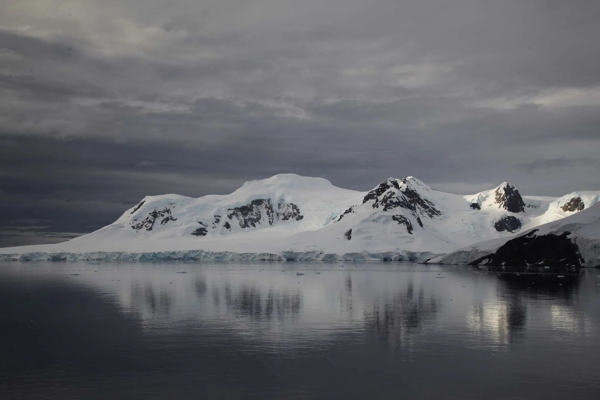
Antarctic Peninsula. Photo: © Anne Lydiat, 2019

Antarctic Peninsula. Photo: © Anne Lydiat, 2019
Antarctic Peninsula. Photo: © Anne Lydiat, 2019
Day 6: 4 March 2019, Neko Harbour. 64.8331° S, 62.6664° W
Neko Harbor is an inlet of the Antarctic Peninsula on Andvord Bay, situated on the west coast of Graham Land. Neko Harbour was discovered by Belgian explorer Adrien de Gerlache during the early 20th century. It was named for a Scottish whaling boat, the Neko, which operated in the area between 1911 and 1924.

‘Ship Drawing’, Neko Harbour, 4 March 2019. © Anne Lydiat

R/V Laurence M. Gould, American IIce Breaker and Oceanograpic Research Ship, Neko Harbour. Photo: © Anne Lydiat, 2019

Neko Harbour. Photo: © Anne Lydiat, 2019

Neko Harbour. Photo: © Anne Lydiat, 2019

Underway. Antarctic Peninsula. Photo: © Anne Lydiat, 2019
Day 7: 5 March 2019, Damoy Point, Dorian Bay. 64.4904° S 63.3015° W
Damoy Point is a headland 900 metres (980 yd) west-northwest of Flag Point, the northern entrance point to the harbour of Port Lockroy, on the western side of Wiencke Island in the Palmer Archipelago of Antarctica. It was discovered and named by the French Antarctic Expedition, 1903–05, under Jean-Baptiste Charcot.

‘Ship Drawing’, Damo Point, 5 March 2019. © Anne Lydiat

Damoy Point, Dorian Bay. Photo: © Anne Lydiat, 2019

Damoy Point Hut, Dorian Bay. Closed 2006. Now designated as Historic Site No. 84 under the Antarctic Treaty. Photo: © Anne Lydiat, 2019

Damoy Hut, Dorian Bay. Photo: © Anne Lydiat, 2019

Damoy Hut, Dorian Bay. Photo: Anne Lydiat, 2019

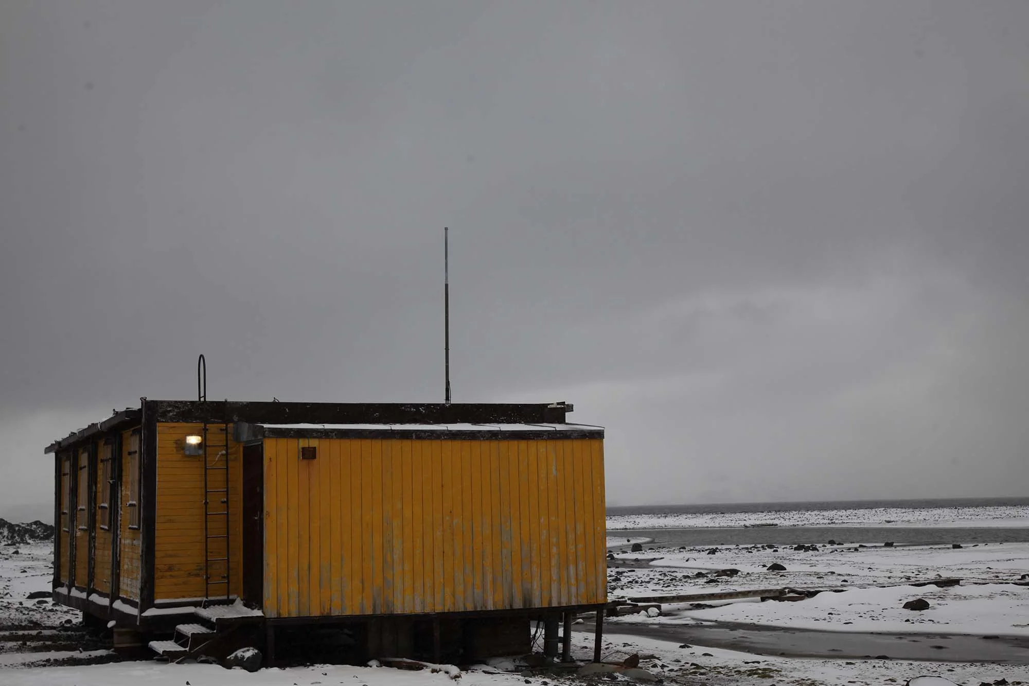
Argentine Emergency Shelter, Damoy Point, Dorian Bay. Photo: © Anne Lydiat, 2019

Argentine Emergency Shelter, Damoy Point, Dorian Bay. Photo: © Anne Lydiat, 2019

Argentine Emergency Shelter, Damoy Point, Dorian Bay. Photo: © Anne Lydiat, 2019

Damoy Point, Dorian Bay. Photo: © Anne Lydiat, 2019

Damoy Point, Dorian Bay. Photo: © Anne Lydiat, 2019

Wake, Antarctic Peninsula. Photo: © Anne Lydiat, 2019

Day 8: 6 March 2019, Arctowski Station. 62.1599° S, 58.4690° W
The Henryk Arctowski Polish Antarctic Station is a year-round research facility managed by the Institute of Biochemistry and Biophysics of Polish Academy of Sciences, established in 1977 on the shoreline of Admiralty Bay on King George Island, off the coast of Antarctica.
It is named after Henryk Arktowski, the Polish geologist, oceanographer and meteorologist of the Belgian Antarctic Expedition from 1897-1899. This was the first expedition to overwinter in Antarctica. Bleached whale bones, relics of the 19th-century whaling history, are scattered around the pebble beach in front of the station, providing a reminder of the past. One of the few lighthouses in Antarctica, Point Thomas lighthouse, is located on the station’s premises.

‘Ship Drawing’, Arctowski Station, 6 March 2019. © Anne Lydiat

Arctowski Station. Photo: © Anne Lydiat, 2019

Arctowski Station. Photo: © Anne Lydiat, 2019

Arctowski Station. Photo: © Anne Lydiat, 2019

Arctowski Station. Photo: © Anne Lydiat, 2019

Arctowski Station. Photo: © Anne Lydiat, 2019

Arctowski Station. Photo: © Anne Lydiat, 2019

Arctowski Station. Photo: © Anne Lydiat, 2019

Arctowski Station. Photo: © Anne Lydiat, 2019
Arctowski Station. Photo: © Anne Lydiat, 2019

Arctowski Lighthouse (active) at Shag Point. Photo: © Anne Lydiat, 2019
Day 9: 7 March, Open Sea

‘Ship Drawing’, At Sea, 7 March 2019. © Anne Lydiat

Wake, Southern Ocean. Photo: © Anne Lydiat, 2019

Open Sea, Southern Ocean. Photo: © Anne Lydiat, 2019

At Sea, Atlantic Ocean. Photo: © Anne Lydiat, 2019

Open Sea, Atlantic Ocean. Photo: © Anne Lydiat, 2019

Open Sea, Atlantic Ocean. Photo: © Anne Lydiat, 2019
Day 10: 8 March, International Women’s Day, Open Sea

Open Sea, Antarctica. Photo: © Anne Lydiat, 2019

Open Sea, Southern Ocean. Images: Sabine Barth. Photo: Anne Lydiat, 2019

Open Sea, Southern Ocean. Images: Sabine Barth. Photo: Anne Lydiat, 2019
Open Sea, Southern Ocean. Images: Sabine Barth. Photo: Anne Lydiat, 2019

Open Sea, Southern Ocean. Images: Sabine Barth. Photo: Anne Lydiat, 2019

Open Sea, Southern Ocean. Images: Sabine Barth. Photo: Anne Lydiat, 2019
Day 11: 9 March, Port Stanley
Capital of the Falkland Islands, overseas territory of the United Kingdom

‘Ship Drawing’, Port Stanley, 9 March 2019. © Anne Lydiat

Port Stanley. Photo: © Anne Lydiat, 2019

Port Stanley. Photo: © Anne Lydiat, 2019

Port Stanley. Photo: © Anne Lydiat, 2019

Port Stanley. Photo: © Anne Lydiat, 2019

Port Stanley. Photo: © Anne Lydiat, 2019

Port Stanley. Photo: © Anne Lydiat, 2019

Port Stanley. Photo: © Anne Lydiat, 2019

Umbilical Connection, Port Stanley. Photo: © Anne Lydiat, 2019

Rat Guard, Port Stanley. Photo: © Anne Lydiat, 2019
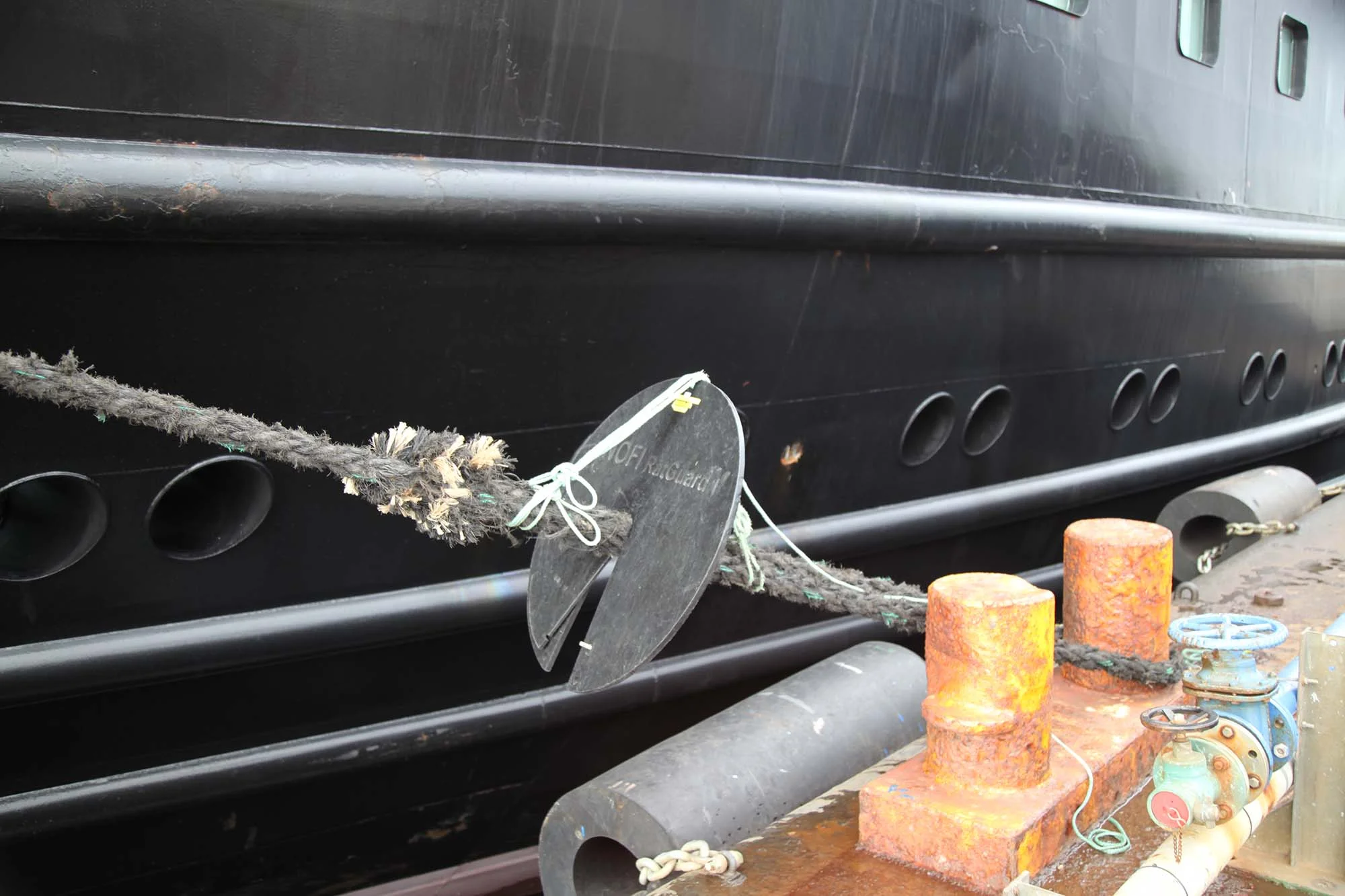
Rat Guard, Port Stanley. Photo: © Anne Lydiat, 2019

Umbilical Connection, Port Stanley. Photo: © Anne Lydiat, 2019

Umbilical Connection, Port Stanley. Photo: © Anne Lydiat, 2019
Day 12: 10 March, West Point Island
One of the Falkland Islands, originally named Albatross Island.

‘Ship Drawing’, West Point Island, 10 March 2019. © Anne Lydiat

West Point Island, Falklands Islands. Photo: © Anne Lydiat, 2019

West Point Island, Falklands Islands. Photo: © Anne Lydiat, 2019

West Point Island, Falklands Islands. Photo: © Anne Lydiat, 2019
West Point Island, Falklands Islands. Photo: © Anne Lydiat, 2019

West Point Island, Falklands Islands. Photo: © Anne Lydiat, 2019

West Point Island, Falklands Islands. Photo: © Anne Lydiat, 2019

West Point Island, Falklands Islands. Photo: © Anne Lydiat, 2019

West Point Island, Falklands Islands. Photo: © Anne Lydiat, 2019

Albatross, West Point Iland, Falklands Islands. Photo: Anne Lydiat, 2019

Albatross, West Point Iland, Falklands Islands. Photo: Anne Lydiat, 2019

West Point Island, Falklands Islands. Photo: © Anne Lydiat, 2019

West Point Island, Falklands Islands. Photo: © Anne Lydiat, 2019

West Point Island, Falklands Islands. Photo: © Anne Lydiat, 2019

West Point Island, Falklands Islands. Photo: © Anne Lydiat, 2019

Flora, West Point Island, Falklands Islands. Photo: © Anne Lydiat, 2019

Flora, West Point Island, Falklands Islands. Photo: © Anne Lydiat, 2019

MS Midnatsol anchored. West Point Island, Falklands Islands. Photo: Anne Lydiat, 2019

Day 13-16: 11-14 March, At Sea

‘Ship Drawing’, At Sea, 11-14 March 2019. © Anne Lydiat